Geographic Overview
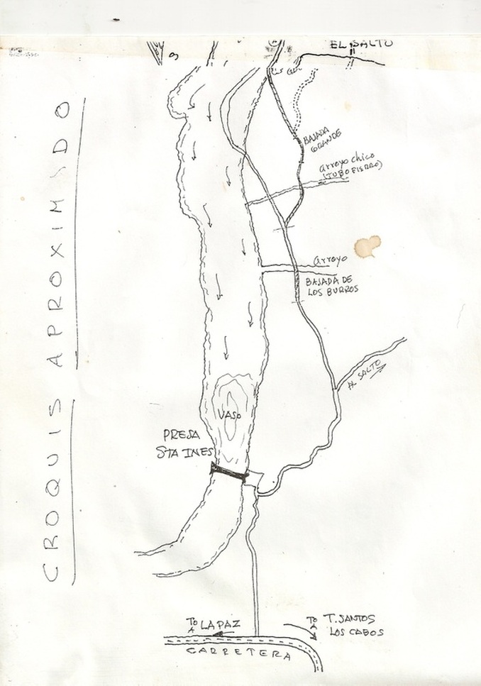
This is part 1 of a 2 part hand drawn map into the Eco Village site, starting from the highway and going up past the dam/reservoir titled Presa San Inez.
The road gives 2 choices, with the one to the left being up the Arroyo and called the dry road for when water is not flowing, which it is not for the Nov. 12th - 15th Council meeting and is faster that the "wet road going over the hills at that point.
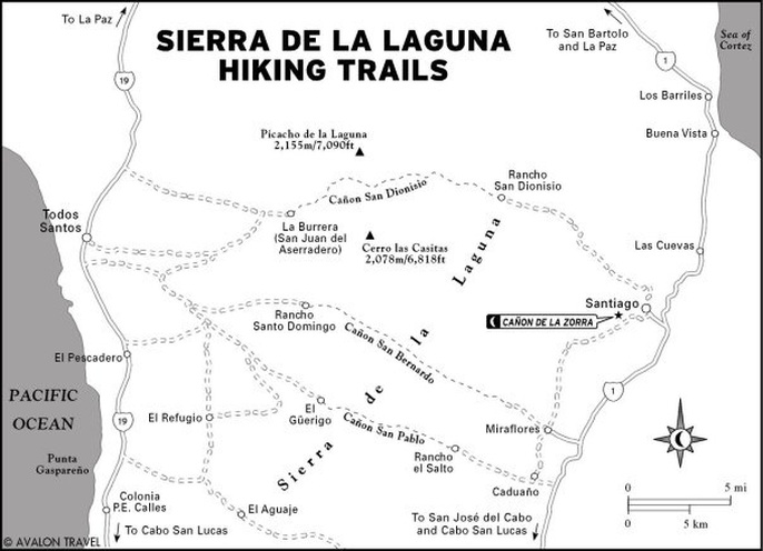
Match it to the below Hiking Trails map and Google Earth satellite views and there should be no problem finding the site.
Part 2 of the map is below this Part 1.
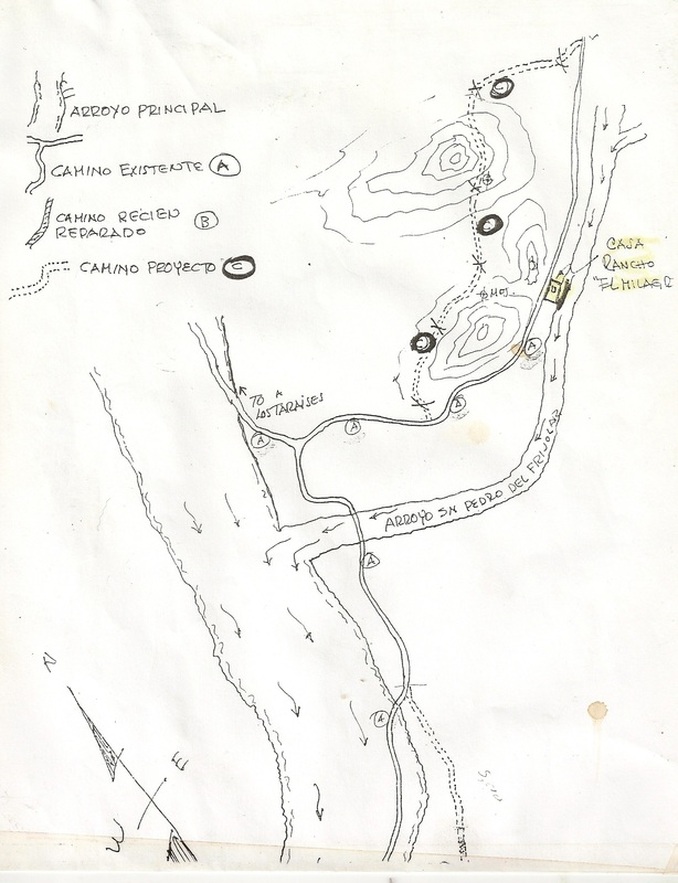
Part 2 of the map into the Eco Village site, presently named Casa Rancho El Milagro (de la Sierra: not included on the map) brings you home and the main building pictured in the photos is plainly visable on the right of the road, through the fenced off buildings and orchard area of the site on the right of the road. The fence is of course to keep livestock out.
The illustrated "Camino Proyecto C" with the Xs is the Projected Road over that part of the land best suited for home sites as things move along and begins at that end of the properties' boundaries.
Welcome Home.
The illustrated "Camino Proyecto C" with the Xs is the Projected Road over that part of the land best suited for home sites as things move along and begins at that end of the properties' boundaries.
Welcome Home.
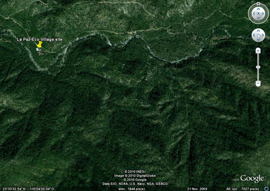
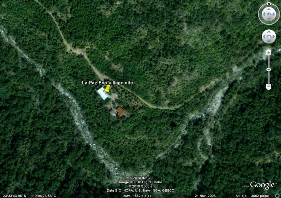
The actual location for the La Paz Eco Village is marked on Google Earth, along with a waypoint/turn-off from the main road (seen on the Hiking Map between highway marked 19 from La Paz to Todo Santos) and an untitled marker/waypoint at the Presa (Presa means reservoir) San Inez for those using Google Earth. The main building and old ranch house are plainly visable, titled and tacked beyond that. Follow the Yellow Tacked road in.
Search Baja California Sur, Mexico on Google Earth and the tacks are noted with the name, turn-off....
Search Baja California Sur, Mexico on Google Earth and the tacks are noted with the name, turn-off....
This satellite view shows the coastline at Todo Santos in relation to the Eco Village site. The 3 markers are: on the left the turn-off from the main highway (the buidings depicted by the highway are green houses and agricultural type structures); the marker "Marca de posicion sin titulo" is the dam at San Inez Reservoir set as a waypoint; and the La Paz Eco Village site is plainly marked. If you print out a copy and compare it with the actual Google Earth program you can zero in on whatever aspects you wish.
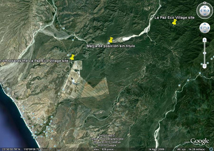
Google Earth Satellite view
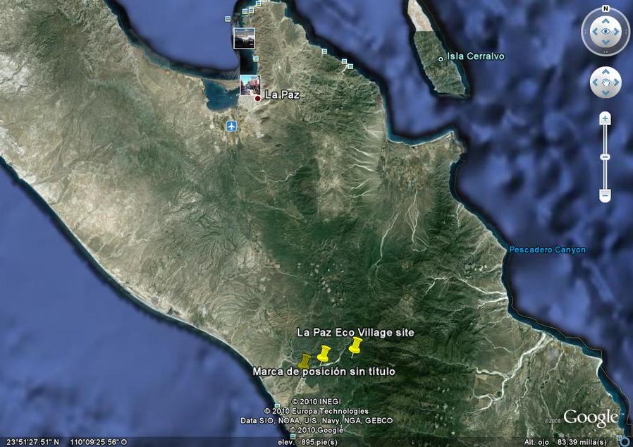
This Google Earth view gives you perspective as to where the La Paz Eco Village is in relation to the City of La Paz, going over to the Pacific side of the Baja California Sur Peninsula at Todo Santos
This view is essentially the property overall with the main building pinned. The view below this is a closer up one of the main building, old ranch house, orchard, creek bed and area around.
